Sailing to the most remote settlement in the World – Part III

What makes Tristan da Cunha unique is the Tristanians themselves and their geographical isolation, not so much the island. I have much less to share about the Island than about the Settlement, but it certainly doesn’t lack in beauty and I have many pictures of my hiking there.

009---01

About halfway between the Settlement and the Potato Patches, one comes upon this large hill, “Hillpiece”, a 200 m high scoria cone, composed of very light rocks produced when gas fills the volcanic magma with bubbles. The patterns exposed by its erosion into the ocean are quite spectacular and indicate the many layers of eruptions to the expert’s eye. Unfortunately, the expert is not me.

009---02

Hillpiece is quite steep, but an easy climb, because the ground is almost like steps. I could probably pretend that it’s a very difficult climb and that I’m awesome for having completed it, but there is a big fat cow on the summit. She wasn’t parachuted there so I won’t pretend.

009---03

This strange hole is believed to be caused by a sudden release of underground gases, which blows off the top surface of the soil. Some are larger, but the phenomenon seems rare. I only saw two. Since I was walking on the hill, I consider this rarity to be a good thing.

009---04

The Settlement, seen from the top of Hillpiece. In the foreground, the road to the patches and in the background, the MV Baltic Trader, my ride back to Africa.

009---05

The Potato Patches from the top of Hillpiece. I asked a few people why the patches were so far from the settlement, especially considering that when they were placed there, people had to go by donkey. More fertile ground, better wind protection, I heard a few theories but nobody had a definite answer. A reasoning that disappeared with the person who made the decision, perhaps.

009---06

I found a few markers on the top of Hillpiece. Here’s a hypothetical bar conversation:

– I was in the US Army in 1968.

– Me too. Vietnam?

– No, Tristan da Cunha.

– …

[End of conversation]

009---07

The beach. Don’t know how often Tristanians use it, but they did build a small set of stairs to get there from the top of the cliff.

009---08

How far do I have to travel not to have tourists in my pictures? (Actually, as I am writing this a few weeks later, I now know the answer: Southern Namibia).

009---09

Cold, wet hardened lava beaten by the waves. It’s quite beautiful, but there are not many swimmers. Apparently, Tristanians do use the beach, but October is much too early in the Spring to do so.

009---10

The cliff facade. Incredible what volcanic activity does to rocks.

009---11

From the very end of the the patches, before the volcano cliff goes straight to the sea, you can just see Nightingale Island in the distance, on the left side. Inaccessible Island, on the right, is visible from most of the patches. Both are unhihabited, but there were failed attempts at settling on Inaccessible in the past. Nightingale has no fresh water.

Incredibly, just last year, a Maltese registered freighter and it’s Greek captain, while sailing the nearly absolutely empty and inconceivably gigantic South Atlantic Ocean, slammed right into Nightingale, breaking the ship apart and spilling tons of oil all around the island. This event is about as probable as me finding Elvis, alive, in North Korea, and one minute later, both of us being killed in the crash of a Saudi cargo plane chartered by the Mexican Government to transport a Chinese panda to Cancun. I heard many theories. None involved bad luck. Because of the lack of fresh water on Nightingale, the Islanders had to transport a great number of contaminated rockhopper penguins to Tristan for cleaning. There is a pool on Tristan, but last years the kids had to do without, as it was used in the rescue operation.

009---12

On the way back from the patches, I got a little glimpse of the volcano (look for snow in the clouds). It is almost always shrouded in clouds that it creates itself, as the ocean air hits the steep cliffs. The volcano is 2,000 m above sea level and climbing it is a very long and hard day’s endeavour. Because of the danger and the risks of disturbing the wildlife (ex: stepping on nests), two guides from the Island must accompany any expedition. Weather is also a big limiting factor. We were blessed with rare good weather during my stay, but the few guides who go to the top were sick with the flu or busy unloading the ship.

009---13

Finally, we did put together a group with guides to go to the base of the volcano (basically the plateau above the big cliffs you see in many pictures). The climb to Queen Mary’s Peak was cancelled due to availability of guides on Wednesday morning and postponed to Thursday, but I suggested we could try for the base in the afternoon if the weather improved. My suggestion was popular and weather helping, it happened. When we got to the starting point, I was afraid we would go nowhere. I didn’t screw up the exposure on this picture of a beautiful mountain in lovely weather. This is the start of the climb, under rain, mist, drizzle, fog, wave splash, all mixed together at the same time. I was afraid the guides would put a stop to it, but we kept going.

009---14

Less than twenty minutes later and 100 m higher, and the weather was beautiful.

009---15

A little higher. We can see the patches and Hillpiece in the distance.

009---16

And higher.

009---17

And the top of the cliff. I would guess it’s roughly a 700 m climb. Not long, but quite strenuous, as the route mostly goes straight up, with an incline similar to that of a steep staircase. Lying on the ridge of the plateau, I must say the immensity of the ocean is a little dizzying.

009---18

And the volcano. In 5 days on Tristan, I never saw the peak cloud free, even on bright sunny days. The vegetation on the plateau is very different from the pastures below. At that point, the weather would have allowed a hike to the summit. However, summit climbs must depart at dawn to make it back before sunset and we had left at 10:30. Also, we were not prepared in terms of water or equipment for such a long hike.

009---19

This looks like the summit, but it’s not. It goes further up.

009---20

To protect the wildlife, we stuck to a somewhat established path on the plateau. I normally would not get so close to a nesting atlantic yellow-nosed albatross, but she chose to put the nest almost right on the path. I realize there is no size reference in the picture, but these are very large birds. They only live on Tristan and the other islands around it. She didn’t flinch as we snapped a few photos. Too bad, that courage cost me a large omelet 😉

009---21

For the second half of the hike down, we took a different route. This steep hill does not look like a safe path at all. In fact, we ran down the whole thing (well, a few of us ran, others walked). It is composed of strange little volcanic pebbles, which makes walking in it as easy as walking down a sand dune. As long as you avoid the rocky parts, it’s safe and a LOT of fun. It’s also very fast, because for every step you take, you slide down as much as the length of the step. I wouldn’t recommend going up that way however.

009---22

I guess we we not supposed to go down that route, so I got arrested. My first time in that part of a police car; not nearly as comfortable as the front seat.

009---23

Sadly, the good weather allowed for the Baltic Trader to be unloaded promptly, and by Thursday afternoon, it was time to go. The mysterious sailors I had seen arrive on the ship 5 days later were no longer mysterious. I had a drink with 3 of the guys in that picture during my short stay, including, in one case, at his house. You make friends quickly on Tristan. Tristanians are a lot more fun than the complete lack of smiles in the picture suggests!

009---24

Five Tristanians (4 adults and a small child) were heading to Cape Town with us, only to return with the Baltic Trader in November. That got a lot of Islanders to come to the harbour to say farewell.

009---25


009---26

The passenger transfer cage being brought back down on the island’s small boat. Loaded on the deck are large numbers of empty gas cylinders. Tristanians use gas for cooking and hot water. The cylinders get refilled in Cape Town.

009---27

The all important mail bags. Mail is hugely subsidized. The Scotsman with us commented that sending a postcard to his neighbour would have cost less from Tristan than from home!

009---28

The South African research vessel SA Agulas II. Much larger than our cargo ship. Little rocking, no deafening engine noise, twice as fast, internet at sea; I wasn’t jealous at all.

009---29

Our South African cook, Neville, gives a fishing lesson in three easy steps. First, you must spare no expense when it comes to equipment. Without expensive, state of the art fishing equipment, you will catch nothing. Once you equipment is ready, throw it overboard.

009---30

Wait thirty seconds to one minute and pull everything out (there are actually three hooks on the line, all have a similar fish).

009---31

Remove fish.

009---32

Neville showing off the bigger catches he got while we were on the island. I had a telephoto lens on to photograph the birds, so even though I was almost falling backwards into the sea, I couldn’t get the whole fish in the frame! Neville looks younger than he is. He has been working at sea for longer than I have been alive.

009---33

The birds fighting over the scraps of bait thrown in the water. They are not as dumb as they look; they don’t wander very far when fishing is going on.

009---34

Waiting for more, no doubt.

009---35

I was surprisingly sad to leave Tristan. Granted the prospect of an upcoming 8 days at sea on a cargo ship might have had an effect on my mood, but I really wish I could have stayed a couple of weeks. That’s the problem with Tristan’s shipping schedule for tourism, your stay can either be too short or too long. However, if I had some sort of contract or project, I would love to stay for a few months.

009---36

An hour later.

009---37

My last sight of the island.

009---38

The only cargo we brought back. Three containers of frozen crawfish (apart from the mail and gas cylinders). Remember there is no port on Tristan, so these can only get off the ship in Cape Town. On Tristan, they are filled by hand, one small crate at a time.

009---38b

Apart from all the great memories, one thing I got from Tristan is one of the World’s rarest passport stamp!

009---39

Last sunset on the Baltic Trader, from the lifeboat deck.

As I write this from Namibia, I already miss my Tristan adventure. I have seen beautiful places around Namibia, but they lack the excitement of Tristan. I wonder how much of it comes from the difficulty of actually getting there. I wonder if I would have gone to Tristan if it had an international airport?

Right now I am on the Namibian tourist trail (occasionally I am the only tourist, but it’s low season). I’m enjoying myself, but I already crave for something more adventurous. Such adventures require a lot of planning, however. Perhaps I’ll soon take a break and plan more adventures of that kind. We shall see.

PS: About the arrest: to save time, we drove to the base of the hike and back. We couldn’t all fit in one vehicle, so Inspector Glass kindly gave us a ride there and back!

#UK #TDC

Sailing to the most remote settlement in the World – Part II

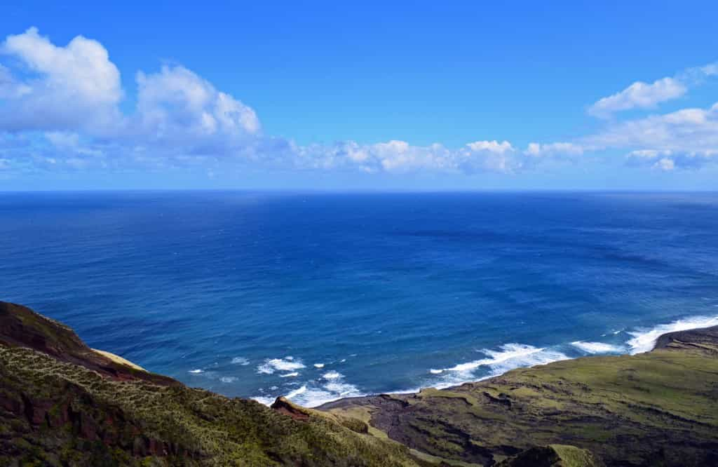
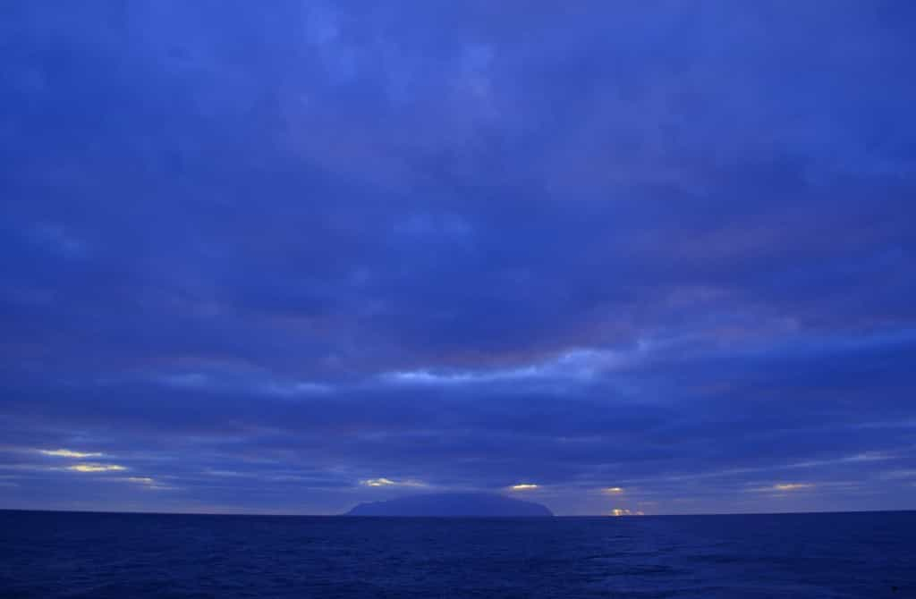
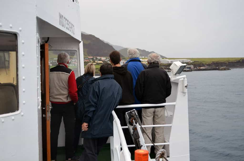
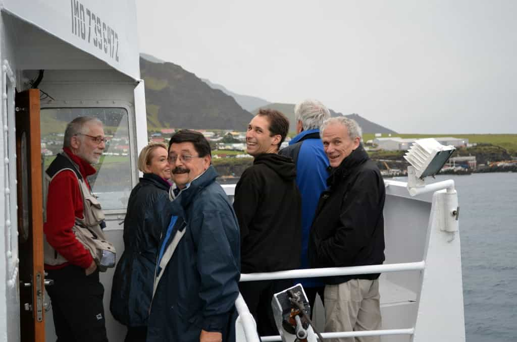
What really struck me when I arrived on Tristan da Cunha is not that is it strange place, but rather that it is not. I flew to the furthest part of Africa from North America and sailed for 10 days to an island in the middle of the ocean. If I had discovered some exotic Bronze Age tribal settlement it would have been less surprising than what I did find: a perfectly normal little British village. Of course, when I stepped off the transfer boat and the Secretary to the Island’s Administrator said: “You must be Colin!”, I knew I was not in just another British village. She introduced me to a couple around my age who would be my hosts, as there is no hotel on Tristan. Actually, she introduced me to the wife, as the husband was part of the crew offloading the ship. We walked to the house and my suitcase was delivered later.

008---01

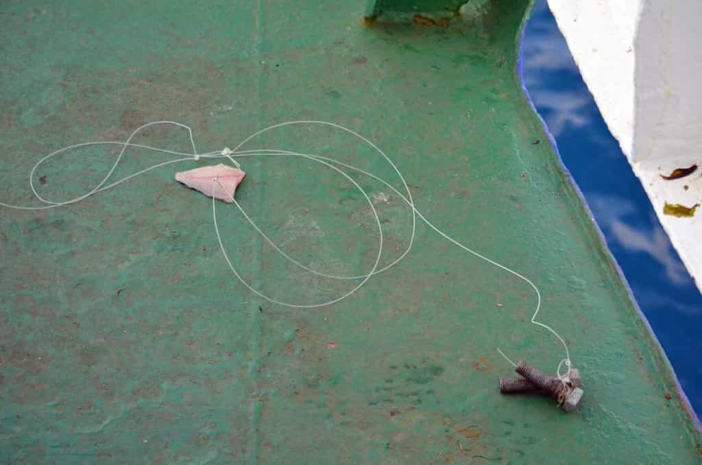
Soon after, my host Debbie was working on this bagful of crawfish. I had booked a home stay including all meals, as there isn’t really a restaurant on the Island. A cafe serves a few things, but only for limited hours. However, there are a few available apartments or in-law suites available for booking.

Since he though he was going to work strange hours, the journalist chose a self-catering option. Talking to him, I discovered a little secret. If you book a home stay, your hosts will cook for you. If you book a self-catering option (at half the price) in theory, you will cook for yourself, in practice, your neighbours will worry about you and bring you more food than you can eat. One night, the journalist went to the dock hoping to get a crawfish or two from the fishermen in exchange for some Pounds, the currency of Tristan. He came back with all the Pounds he had left with and 15 crawfish. Since he only had a medium sized pot in his kitchen, it took him 3 hours to cook them all! These anecdotes are true representations of the enormous generosity and hospitality of the Tristanians.

008---02

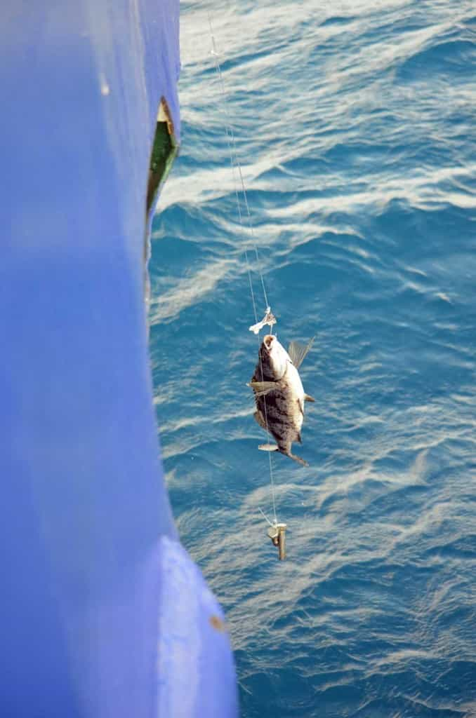
What became of the bag of live crawfish. Tristanians are known to be somewhat camera shy, and I am myself a little uncomfortable photographing people during my travels. One photo I was certainly going to get was one of me with my hosts, but I chose not to. Tristanians are exposed to very few outside germs, and when the Agulas II landed, the flu started to go all around the island. I even heard some of the older people won’t leave their houses when there are outsiders on the Island. Elsewhere in the World, this would be pretty crazy behaviour, but it might be not be so on Tristan. By the time I left the island, both my hosts were home on the doctor’s orders, with puffy eyes and big red noses. If I were in their situation, I certainly would not have liked anyone taking my picture, so I didn’t. I also got sick. I ignored it and took the pain most of my short stay, but on the second night, I did go to bed at 8 to try and kill it, thus missing bingo night.

While planning the trip, and on the long sailing there, I had a chance to read a bit on the history of the place. The island was discovered in the 16th century by a Portuguese sailor who, in a flash of great creativity, named the Island after himself. After a few unsuccessful settlement attempts, the British posted a garrison there in the early 19th century, allegedly in part to prevent the French from using it to mount a rescue operation to free Napoleon from St-Helena. Realizing that Tristan was over 2400 km away, and in the wrong direction, they changed their mind and pulled the troops in 1867. A Scottish artillery corporal asked to remain on the Island with his South African wife and children, along with two workers. Corporal-turned-Governor William Glass led the place until his death in 1853 and is considered the founder of the colony.

The early settlers got most of their income from seal fishing and a few more men moved in. A few years later, five women from St-Helena moved to Tristan and married the five lonely bachelors working there. A famous fact about the Island is that it has only seven last names: Glass, Green, Hagan, Lavarello, Repetto, Rogers and Swain. All these surnames have been on the island since at least 1892. It would be easy to imagine a simple little history where 7 settlers move in with there wives, live happily, have kids and now there are 275 people on Tristan. The truth is a complex history of people moving in, leaving, marrying in or out of the island, and also, catastrophes. For example, after the death of the founder, his wife left the island with all of their 25 descendants. If some had not returned later, the name Glass would not even exist on Tristan. In 1885, 15 men sailed out to trade with a passing ship and mysteriously drowned, leaving only 4 surviving adult males on the island. The Island website, which is very well done and very complete, has an interesting section on history: http://www.tristandc.com/historyhome.php.

008---03

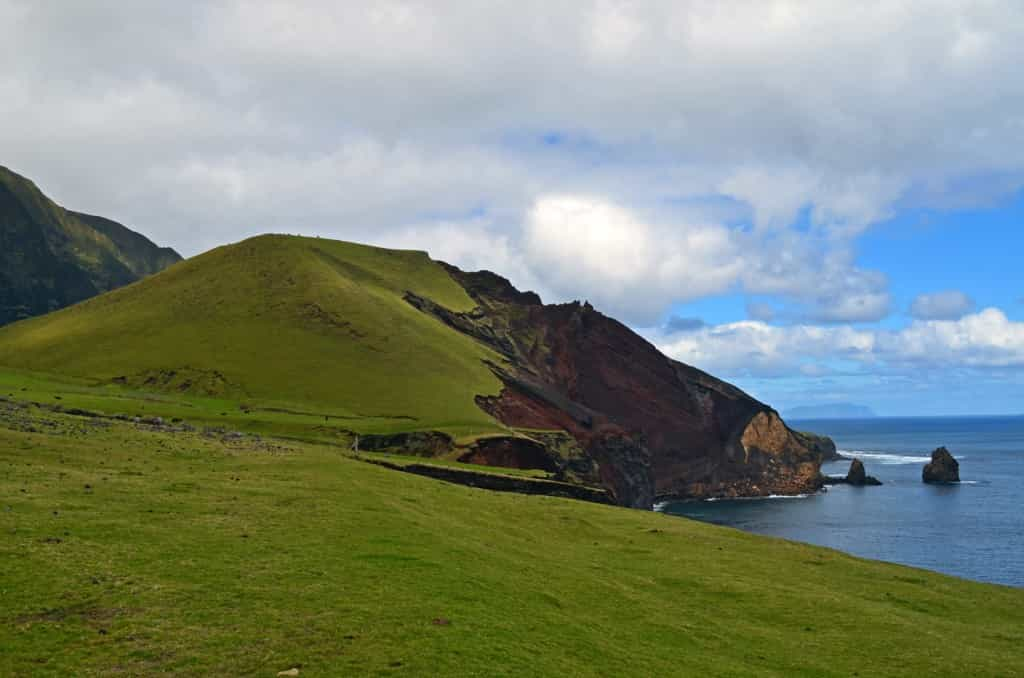
The biggest event in recent history is the volcanic eruption of 1961. It only destroyed one house and there were no fatalities, but a lot of non-residential infrastructure was destroyed and the main beach used for unloading the ships essentially ceased to exist. This picture shows part of the enormous pile of millions of tons of rock that came out of the volcano. The grey circle on the cliff, which is about 45-50 m in diameter, is a volcanic plug, created when magma cools and hardens inside a vent.

All of the inhabitants were evacuated to the United Kingdom after the 1961 eruption. However, they did not like their new lives, particularly the extreme media scrutiny their story attracted. So, in 1963, a few men went back to check out the island and shortly after, all but 5 of the evacuees moved back to the island. Steam came out of the eruption site until the late 1990’s.

008---04

008---05

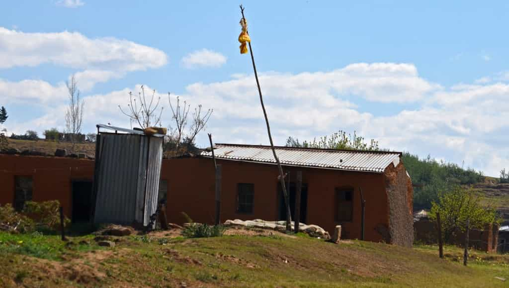
This traditional thatched house is being built at the base of the volcano (obviously, it is not thatched yet). It is being built with local stones, in the traditional style used by the inhabitants before 1961 (I’ll pretend I didn’t see the poured concrete floor…). The aim is to educate the children and the few tourists. Many of these houses still exist all over the village, except the thatched roofs have all been upgraded to metal long ago.

008---06

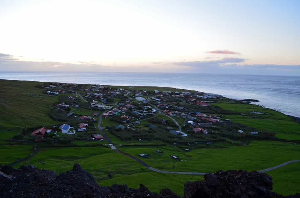
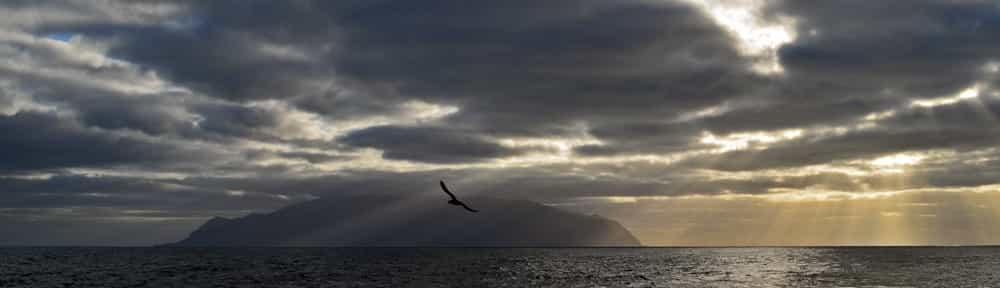
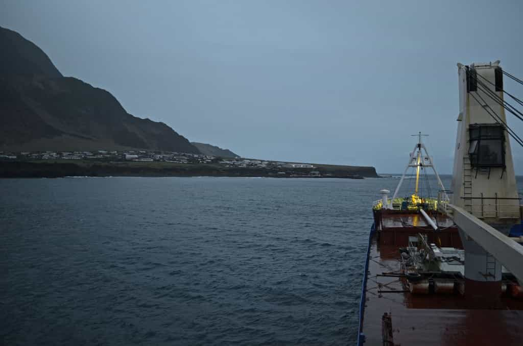
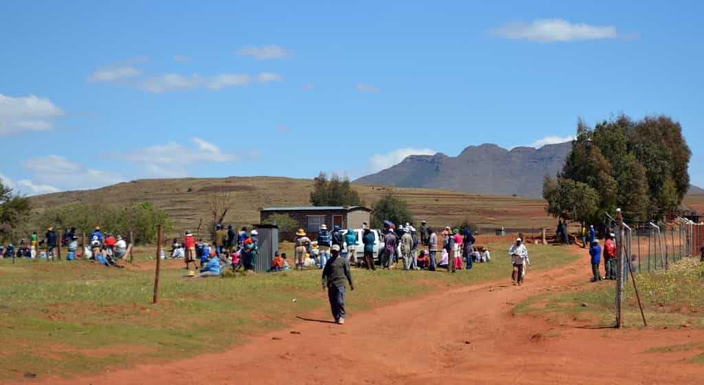
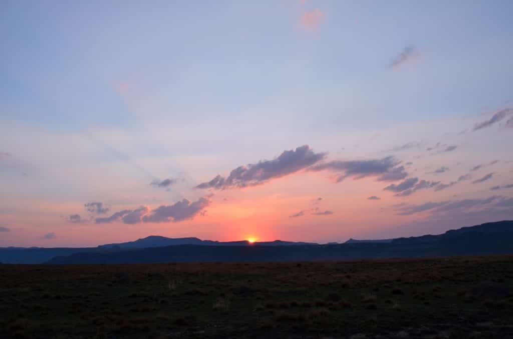
The village of Edinburg of the Seven Seas, as seen from the top of the 1961 volcanic eruption, at sunset. It was named after a visit in 1867 by the Duke of Edinburg, but the village is always referred to as “the Settlement”. As it turns out, the next Duke of Edinburg and the current Queen’s husband, Prince Phillip, also visited, in 1957. The community centre is now named after him. I have not yet been informed of what would be renamed in my honour following my visit; perhaps a fencepost, hopefully a barstool.

The village is fairly dense, so with a population of only 275, you can imagine is does not cover a big area. I got a letter sized paper map of the settlement when I landed on the island. Each house was indicated, with a letter and number on it. On the reverse, it listed who lived in which house! Yet another thing I had never seen before, but it proved very useful.

008---07

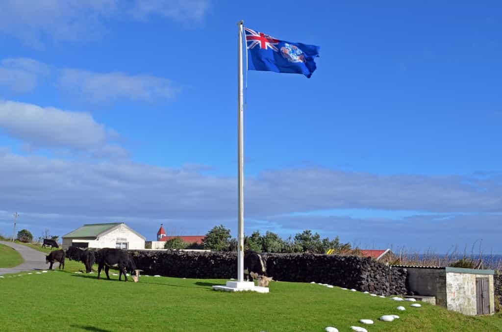
The Island’s flag, with a few grazing cows around the post. This is not a regular sight, as the village is fenced and cattle do not live in it. However, the cows are let in once in a while, which saves the trouble of cutting the grass.

008---08

The Administrator’s residence. Apart from having a much bigger front lawn, which gives it a certain air of importance, it is built pretty much like all the other houses on the island, just a little larger. The Administrator is a member of the British Foreign Office, on a posting of a few years. He presides the Island Council, which is composed of elected and named islanders. I saw him most mornings and he greeted me with: “Good morning Colin!”. The way I get greeted daily by the Executive head of Government in most places I visit, of course. Notice the flag is not the Island’s flag. The Administrator, as the representative of the Governor General, flies the flag of the whole territory of St-Helena, Tristan and Ascension.

The political and economic relations between the Island Council, the Administrator, the Territorial Government in St-Helena, the Foreign Office, Ovenstone and other players seemed complicated and subtle from the little I learned. I will not mislead you by spreading my ill-informed perceptions. However, as far as I could tell, there doesn’t seem to be any major point of discord. One has to remember that for many decades, Tristan had no written laws of any kind and that didn’t stop the Sun from rising. Of course, in modern days, things must be regulated and apparently, an urgent bill was voted in the British Parliament to order Tristanians to drive on the left side of the road, and the bill came into effect the day the number of cars on the Island went from one to two. Perhaps an urban legend, but it’s far from impossible.

008---09

Some race boats next to the Administrator’s residence. Apparently, Tristanians used them in an annual race to one of the nearby uninhabited island, but it hasn’t happened in quite a while. From what I heard, it seems the races stopped around the time Tristan got television service. Not surprising if that’s the case, and that’s why I haven’t had a television in about six years. Interestingly, the topic of television came up on the sailing to Tristan and several of my fellow travellers also didn’t have televisions. As all but two were doctors and engineers, it certainly wasn’t from lack of means, so I will assume it goes with a certain lifestyle.

008---10

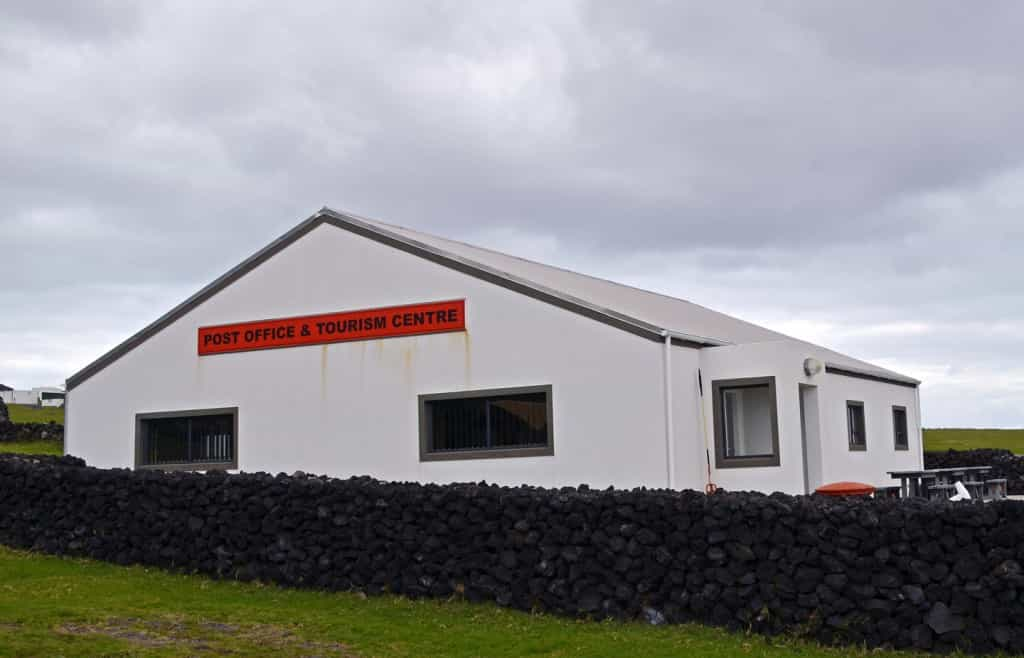
Tristan’s tourism office is probably the largest in the World in terms of surface area per tourist, and all the tourists who visit the island in a year could comfortably fit in it at the same time! However, it also houses the very nice island museum (which was closed for a few years, as it used to be located in a building affected by excessive moisture), the post office, a souvenir shop and a nice cafe.

008---11

The mailbox, in case you want to post a letter when the post office is closed. It made me reflect on the isolation of the island. The island used to be referred to as “the most isolated settlement in the World”. It certainly was for a long time. Around World War I, Tristan had a period of three years without a single ship visiting and went without a single delivery of mail for nine years. Today, “remote” has generally replaced “isolated”. In fact, 275 English-speaking people with television, telephone, internet, a post office and ships to Cape Town are far less isolated than 100 tribesmen who speak only a dying language, with no modern communications of any kind, a 5 day hike out of the jungle to the nearest village, even though the village in question might be only a few tens of kilometres from their settlement.

008---12

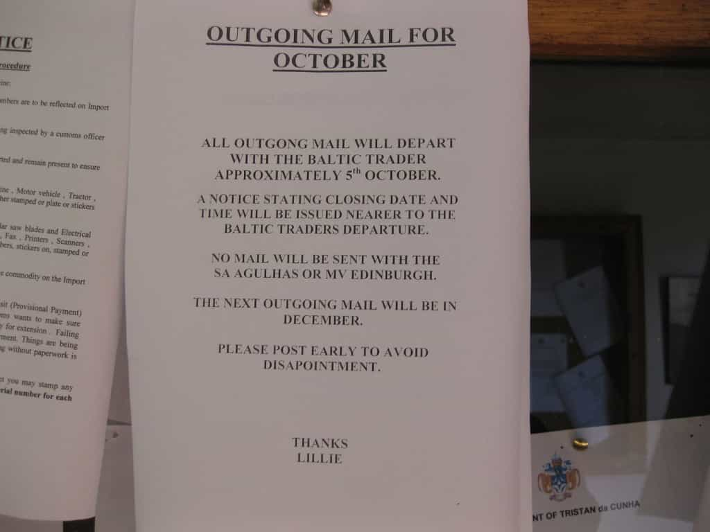
That being said, it is still pretty isolated, as that public notice clearly reminds us.

008---13

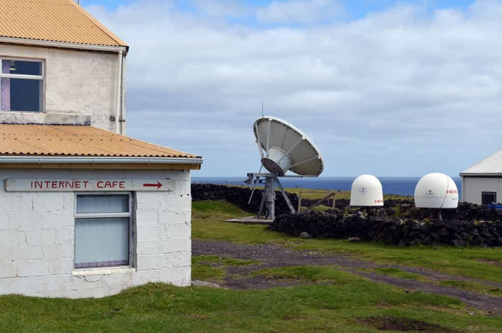
The internet is quite a recent addition to the island. I really appreciated the extreme contrast between the very simple, hand-painted sign on the internet cafe wall, and the not simple at all, very expensive technology that makes it happen a few meters away. Those antennas and dishes provide internet, TV and phone services to Tristan via satellite, at an annual cost to the Foreign Office of about 100,000 Pounds. Anyone can use the internet cafe during opening hours and outside these hours, it sends a wireless signal, but to get it at home, you have to live close to the cafe, which my hosts didn’t. Tourists pay a very reasonable 10 Pounds and get access for the duration of their stay. However, if you need internet access to download a couple of HD movies, plan to stay there for about a year or two. Two television channels are broadcast on the island: British Forces Broadcasting Service 1 and 2. The night I was feeling sick and stayed home, I watched an episode of Downton Abbey! Sometimes the World seems so big, and sometimes it seems so small.

008---14

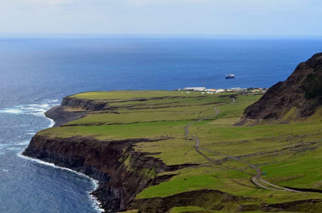
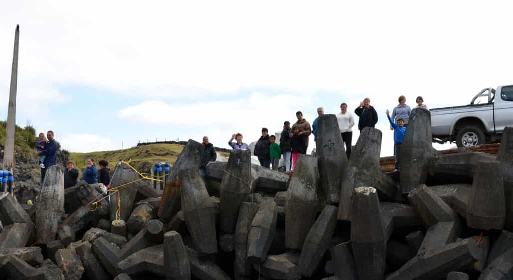
Elsewhere in the Western World, most villages of 275 people would have pretty much nothing in terms of services and one would expect to have to drive to the nearest town for most necessities. Because of its extreme isolation, Tristan needs to have everything. Or I should say, all the basic necessities. If you really need a hot yoga studio, an authentic Ethiopian restaurant and pole dancing classes; you’re out of luck. But a small port they have, Calshot Harbour. The big logistical problem is that it can only serve the local fishing, rescue and pontoon boats, which makes unloading the cargo ships very complicated and time consuming. I heard building a proper port is a long debated idea, but it would certainly be a very major undertaking for such a small community.

The hospital normally has one doctor on a six month contract and a few locally trained nurses. Tristanians can complete high school on the island, but must go away for further training. I met several who completed different trade and academic programs in South Africa and the UK, but mostly short to medium term programs. Going away for four years to complete a university degree, say in nursing, doesn’t seem to happen. Given the academic and shipping schedules, doing that would probably mean four and a half years abroad without returning. There is no dentist on the island, but one comes every year for a few a period of a few weeks.

008---15

Two of the island’s last names, Lavarello and Repetto, originate from the shipwreck of an Italian vessel near Tristan in 1892, when two of the sailors decided to stay. I believe they were the last male immigrants to the Island. The hospital is named after the Italian village of Camogli, where the sailors were born.

008---16

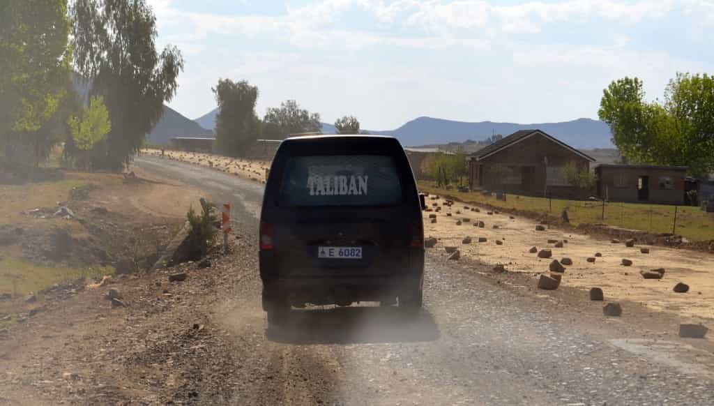
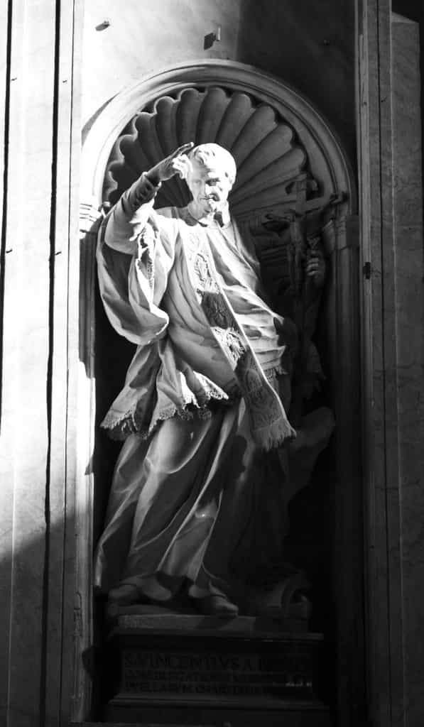
Despite the population of only 275, there are two religions on Tristan. Since people immigrated from the UK, South Africa, the US, Ireland and Italy, they are, unsurprisingly, Anglican and Catholic. Unlike in Lesotho, I saw no Taliban on Tristan. This is the Catholic church.

008---17

There is only one police officer on Tristan. Like most Tristanians, he has a number of jobs. He is also the immigration officer, is probably involved in fisheries policing and other things. I would say most Tristanians have two jobs, and fit men have three. And that’s not counting house work. First, they have their “day jobs”. For example, my host was an electrician. But they also produce most of their food. This is not done by specialized farmers, but by each family. and it includes growing vegetables, raising cattle and fishing. I will come back to this later.

Finally, many men also participate in communal work. For example, the morning after we arrived, a big bell rang at 6:00 in the morning. This was the signal that the weather was good and that the unloading of the ship could proceed. So my host got ready and went to the docks. No electrical work happening that day. Other labour intensive tasks, such as replacing a family’s roof, are also done in this fashion. Because of this, most essential administrative tasks, such as running the local government, store or post office, are done by women, as they don’t disappear for two days in the middle of the week to go fishing or build something.

008---18

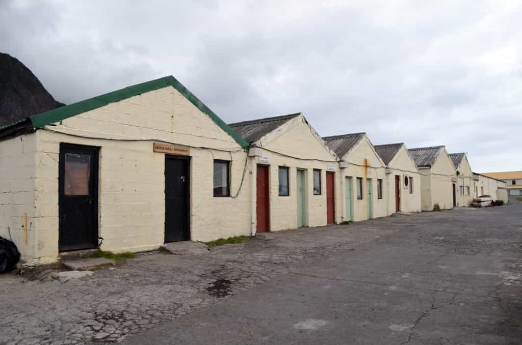
This row of buildings constitutes the commercial street. The last large building is the supermarket. Not a lot of effort has been invested in the exterior appearance, but I guess competition is not so fierce. Inside however, the supermarket is nice and stocks all the daily necessities of life, from clothes to foodstuff to alcohol and soap and dog food and make-up. However, it does not stock large items such as furniture or televisions, and certainly not cars or tractors. To buy such things, Tristanians have the supermarket order them from Cape Town and they arrive on the next ship. A good way to curb compulsive shopping! The other stores are specialized outlets like plumbing and electrical supplies. Actually, they may be more like the island’s plumbing and electrical departments, rather than stores. I’m not sure.

I got the impression Tristanians don’t make a lot of money, but it certainly doesn’t show. Their economic reality is quite different from the mainland. First, all land is communal, so one does not have to buy it to build a house. Second, they build their own houses, with the help of friends and family (or inherit them, I suppose). Third, they produce most of their food and finally, while gas may be expensive, there is nowhere to drive to, so you don’t have to fill the tank very often! This doesn’t leave a lot of expenditures, so the economic quality of life seems quite good, even though imported goods cost a little more than they do in Cape Town. There is also a very high level of economic equality, as most salaries are very comparable. I don’t know how much pensioners earn, but I am sure they are well taken care of.

008---19

Hottentot Gulch is the entrance to the only road leading out of the settlement. It leads to the agricultural area, appropriately called the “Potato Patches”. As you can see, the road is not exactly designed for high speeds, but since it is only 3 km long, that hardly matters.

008---20

The bus terminal! I was most sceptical of this bus service, especially since the only person I saw on it was a tourist. However, this was just before lunch and the bus came back full, mostly of older people. They had spent the morning working on their patches and were coming back for lunch. Pensioners ride the bus for free and I suspect many don’t have cars. As a matter of fact, I find it hard to imagine why someone would need a car on Tristan, yet it seems all families have one. Many even have more than one vehicle, or nice 4×4 trucks. I suspect a little status symbol might be involved with the current adult generation. In the days of their parents, the Island would only have had a handful of vehicles.

008---21

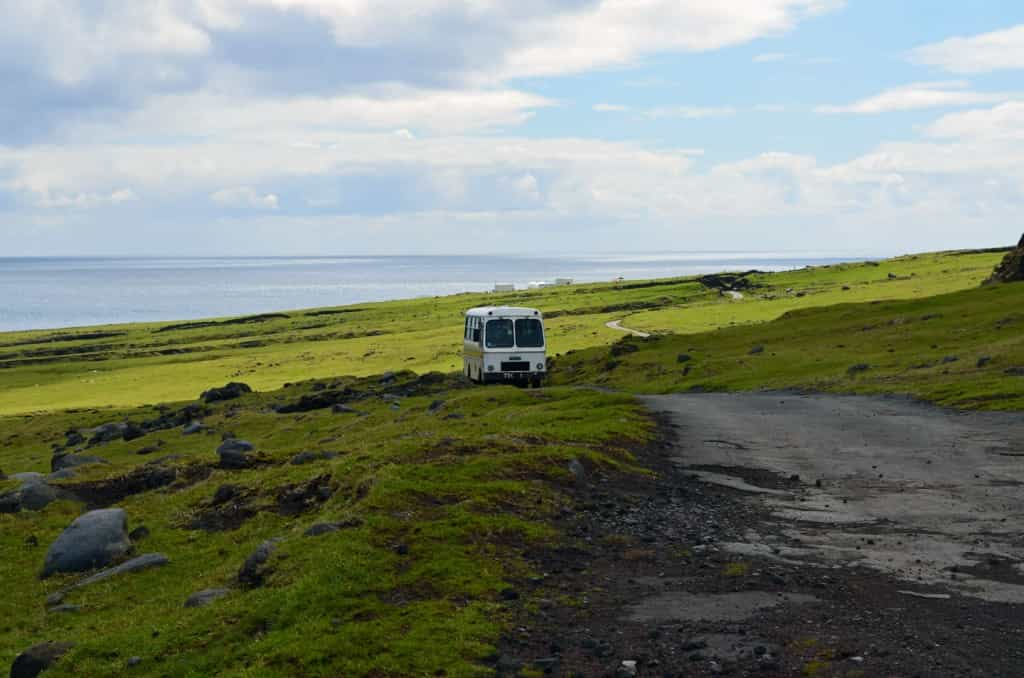
The bus, “loaded” with one Norwegian journalist. It does the return trip between the Settlement and the patches 4 times a day. I love its licence plate number: “TDC 1”.

008---22

This is an example of a family “patch”. Basically a small garden, fenced by stone walls to prevent other families from going in and stealing the vegetables. […] Just making sure you were paying attention! It’s to keep the grazing animals out. There is no one working in them because the bus had just taken the islanders back home for lunch (at that time of the day, most would have been pensioners).  Also, this is the beginning of the spring, hence the fact that not much is growing yet. Despite the name Potato Patches, Tristanians grow a wide variety of vegetables and even some fruits, which surprised me, given the harsh climate.

Space is allocated by the Island Council. Despite being a modern British village, there are many collectivistic aspects to life on Tristan. This is necessary due to the extreme scarcity of certain resources, mainly land. The island is a fair 98 square km, but the vast majority of this is unusable, steep volcano cliffs, as you can see very well in the background of the previous picture. Grazing and agricultural land is very limited. Therefore, families are allocated a certain number of cattle heads. You can have, for example, a cow and 4 sheep. It’s a free country, so if you save a lot of money, you can go buy yourself a fancy truck, a giant flatscreen TV or whatever else strikes your fancy, but not a second cow. Chicken are also raised, but I saw no pigs. In the old days, donkeys were used for transportation. When they became obsolete, they were allowed to live the remainder of their lives grazing around the island in peace, but they were sterilized, so the population just naturally disappeared.

008---23

One of the bus stops at the patches, besides some cottages. Some families have simple, tiny sheds next to their patch where they store tools and other things. Others build elaborate cottages, some even with gas and electricity, and actually stay in them from time to time. Mainly, like anywhere else, going to stay at the cottage is a week-end affair, also very popular during the three week Christmas vacation the whole island enjoys. There is nothing unusual about such an activity, but it is somewhat funny that the cottages are only a 5 minute drive from the village!

008---24

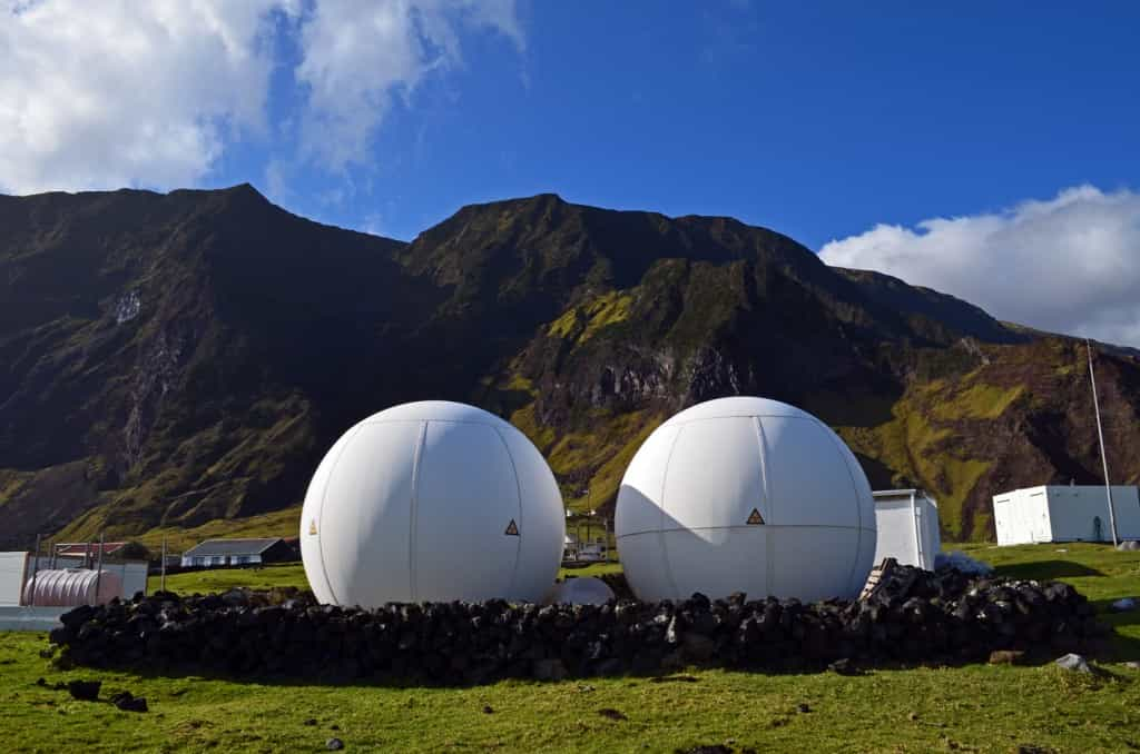
The “eggs”, one of the most unusual sights on Tristan. This is part of a monitoring station of the UN’s Comprehensive Test Ban Treaty Organization. It conducts seismological, hydroacoustic and airborne radionuclide monitoring to detect any signs of nuclear explosions around the World. I visited with the French engineer who had just arrived for a one year contract. The station has some extremely sensitive equipment and is mostly automated. He makes sure everything is running smoothy. The Ovenstone fish plant used to provide electricity to Tristan 16 hours a day and at night, the generators would be turned off. The arrival of this station created a requirement for 24 hour electricity and it is now available throughout the Settlement 24 hours a day.

008---25

The World’s most remote golf course, and probably also one of the worst. Between the crazy ocean winds, the large rocks all over the place and the dogs who will run after your ball and bring it back (or not), I don’t think the course will make the pro circuit anytime soon. I never saw any locals playing, so I suspect it’s a bit of a joke, but tourists do play and get a good laugh out of it.

008---26

Prince Phillip Hall, the community centre, which also house the Albatros Bar, my favourite place on the island. Tristanians sure like to party. I was very sorry our schedule did not allow a full week-end on the island, as there is a dance which turns into quite the celebration every Saturday night. Nevertheless, I saw the place packed a couple of times during the week.

I will admit to being a bit of a drunk, but on Tristan I was the one being told “Come on, stay for another drink”, everyday. On Sunday the pub closes early, so I had a few drinks with my host at home and then we went to have a few more at his friend’s place. Monday night was my sick night, but Tuesday and Wednesday, I closed the bar and went out to people’s places afterwards. OK, so Tristan is not Ibiza, last call is at 9:30, but not a lot of people refuse the last call (and they mostly have a very early work day, like 7 am to 3 pm – unless they are offloading the ship, in which case it’s more 6 am to 6 pm). Alcohol is also crazy cheap. The first night at the bar I ordered a round: two cans of beer, a double shot of gin and a brandy and cola. The bill: 2 Pounds 98 Pence (less than $5). On the second night, the place was packed following a show by the school kids in the hall and I waited 10 minutes to order 3 beers. To avoid having to wait again, I ordered 6 instead. The barmaid gave me a six-pack of cans still wrapped in plastic and a 4 Pound 80 Pence bill ($7-8)! That made me think of what one of the ship’s crew had told me about the cargo they were carrying: “A couple of trucks, concrete, different little things, but mostly alcohol!”

008---27

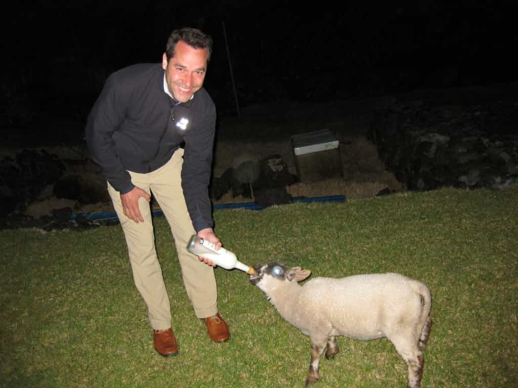
You know how it goes: you go out for a few drinks, end up closing the bar, go drinking some more at someone’s place and next thing you know, you’re bottle feeding a lamb at midnight. Always the same story…

In part III: Hiking around Tristan da Cunha and the voyage back to Africa…

#UK

Sailing to the most remote settlement in the World – Part I

I made the decision that my lengthy travels would take me, in priority, to distant and hard to reach places that I could not get to on a short vacation from work. The first ones were going to be Madagascar, Reunion and Mauritius (including Rodriguez Island). Since deciding to travel full-time, money became a little more valuable to me and time, a little less so. Therefore, I looked online to see if I could get ferries between the islands, as the flights were quite expensive. I found a site listing all ferry connections in Africa, and saw a Cape Town – Tristan da Cunha connection on it (a little ironic since technically speaking, there is no ferry to Tristan). I had never heard of such a place and I Googled it right away. Tristan da Cunha: the most remote inhabited settlement on the planet. Two and a half seconds of reflection later, I was going to Tristan, or at least trying, and if possible, it would be my first destination. My travels to far flung places would start with a bang!

Along with St-Helena (where Napoleon was exiled) and Ascension Island, Tristan is a British Overseas Territory. The Governor General resides in St-Helena, by far the largest Island in terms of population. Tristan itself is one of a group of Islands in the far Southern Atlantic Ocean. Nightingale and Inaccessible Islands are nearby but uninhabited. Gough Island is several hundred kilometres away, also uninhabited, although the South African Government maintains a manned weather station there, since it is on the path of the storms that hit the Cape Coast.

Basically, Tristan’s claim to fame is that it is located 2430 km (1519 mi) from the nearest inhabited settlement (the tiny island of St-Helena) and 2816 km (1760 mi) from the nearest continental based city (Cape Town), thus making it the most remote permanently inhabited settlement on the planet. It does not have an airport, nor any port facilities. It is obviously way out of reach of any helicopters and too far to the South to be along the sea routes between Africa and South America. Around 275 British citizens call it home, along with a few contractors who spend anywhere from a few months to a few years there.

Credit: Kelly Whybrow. I would have liked to take a similar shot, but I was short one helicopter on my equipment list.

This picture is all over the internet and was taken by a helicopter from HMS Endurance in 2007. When I first saw it, I just knew I had to go there. It is important to remember that Tristan is an active volcano. The last major eruption occurred in 1961 and all inhabitants had to be evacuated to the UK. As it turns out, they hated it there and, in 1963, all but 5 returned to the Island. This is a very important moment in the recent history of the island and books on Tristan generally speak of the pre and post evacuation periods.

So, how does one travel to Tristan? The first step is to ask, as permission from the Island Council is required to land there. I emailed the Secretary to the Administrator last summer and, following a meeting of the Council in August, I was given the thumbs-up. This was a very last minute affair; I got permission on the 28th of August for a sailing on the 20th of September. Some people have to plan more than a year ahead to go to Tristan. To be fair, the permission business sounds stranger than it really is. For a single traveller coming for short-term tourism, I do believe it is a formality. If you were to contact them on behalf of Carnival Cruiselines and propose landing 2000 passengers over Christmas, you might get a different answer. That being said, the Island Council also controls who gets a spot on the ships doing regular sailings to Tristan, and that is anything but a formality. There is a system of priority, with 8 levels. Number one is urgent medical evacuations and number 8 is tourism by a non-resident. The top priorities can also bump the bottom ones. So the day before your sailing from Cape Town, someone can fall ill on the Island and guess what? You’re not going. Someone can also fall ill while you are on the Island and guess what happens then? You’re not leaving! You would have to wait at least a month for another ship to arrive.

There are three ways to get to Tristan. The first is to get a berth on a fishing vessel or a cargo ship that Ovenstone sends up to 9 times a year. Ovenstone is a Cape Town based fishing business which holds the fishing rights for crawfish (rock lobster) in Tristan’s territorial waters. They also purchase the crawfish the islanders catch and process on site for export. Among the many complexities of this contract (which I was told provides 80% of the island’s income), is an obligation for Ovenstone to provide this passenger and cargo service. These ships can take a maximum of 12 paying passengers and they do the voyage around 9 times a year. A little note, this is apparently an international shipping rule; above 12 paying passengers, you need a doctor on board. You could fit more than 12 if it wasn’t for that.

The second way is to come on the SA Agulas II, a South African scientific vessel which does a resupply mission a year to the weather station at Gough. As part of the agreement to be allowed to install the weather station on Gough, the Agulas must go to Tristan on it’s way to, and from, Gough, thus allowing another cargo resupply mission and a further 40 passengers. You also get to spend about 3 weeks on Tristan while the ship proceeds to Gough (I understand touristic visits to Gough are not possible under any circumstance). The ship is very large, comfortable and fast, with internet at sea and all the bells and whistles, making this sailing very popular. I was told a few weeks ago that the Fall 2013 sailing is already fully booked. As it turned out, this year the Agulas went to Tristan nearly at the same time as one of the Ovenstone ships, the MV Baltic Trader (cargo ship). Since the price is the same, anyone wanting to go around that time would choose the Agulas. This was the maiden voyage of the Agulas II (replacing the Agulas), and it can carry a lot more passengers, which meant that for that one time in the year (probably in many years), there was more availability of transport to Tristan than there was demand. Not only did I get a spot on the Baltic Trader, but it was not even full, with only 10 of the 12 berths taken, a very rare situation (actually 11, but one passenger got sick the day before and did not board).

Finally, you can also go on a cruise ship or your own ship (or a Navy ship, I guess). You still need prior permission, and I read stories suggesting the few large ships which occasionally sail that way are often not allowed to land anyone.

007---02M

The MV Baltic Trader. 86 meters, but only a fraction of that for passengers to walk around.

007---03M

I don’t know if this seems large to you, but it’s not. I must have gone through that little wooden door a hundred times.

007---04M

And we are off, evening of the 20th of September. Behind us, the Grey Fox, a very large container ship. One day, I’ll cross the Pacific Ocean on one of those.

007---05M

I shared this tiny cabin, which has nothing more than what you see, except the bunk beds, a foot from the seat on the left. My cabin mate was a contractor who has been working as the fish factory engineer for three years, a very unusual long-term stay for a contractor. Great guy, but he understandably had a lot of luggage, returning to the island after 2 months of vacation in his native Bulgaria. Our “seating area” thus became the luggage storing area, as the closet was full of other luggage. He had been a ship’s chief engineer for decades before, so he was the number one source of information on naval matters, as most crew members were not very fluent in English.

The two galley (naval speak for kitchen) crew were South African, the captain was Polish, the first officer was Cuban and the rest of the crew, numbering around 8, were Russian. The funniest thing about them were their drastically different looks. The mechanics looked like they had walked off a recruiting poster for a technical school: short haircut, always clean shaven, clean coveralls, hearing protection around the neck, the whole nine yards. The deck hands looked the opposite: crazy messy hair, unshaved, wearing clothes stolen from a homeless shelter in 1983. OK, maybe I’m exaggerating a little, but the contrast was obvious. There was a culture of extreme cleanliness in the engine room; it was clean enough to have dinner in.

Most sailings to Tristan include zero, one, or sometimes two tourists. Because of the effect of the first sailing of the Agulas II, this cargo sailing was very exceptional. Experienced crew told me they had never seen this. Of the 10 passengers, 5 were tourists and 5 had some kind of business on the island, but there wasn’t a single Islander, as anyone who had to return from Cape Town would have sailed on the Agulas. At the risk of sounding like I am flattering myself, tourists and other travellers to Tristan are a very interesting bunch. Here’s the list of the passengers:

1 – The professor,

2 – The millionaire and his wife,

3 – … Wait, wrong list.

Again:

1, 2, 3 and 4: – The doctor, the other doctor, the German doctor and yet another doctor’s girlfriend (yes, really). The previous contracted doctor on the island had a serious health problem himself a few months ago, so an emergency contract was done for a Cape Town doctor to finish the shift. A Royal Navy frigate, which happened to be in the region, picked up the replacement doctor in Cape Town, sailed part-way to Tristan and, when in helicopter range, did the switch. The short-term doctor’s girlfriend, who was great company and provided me with all sorts of information on life in South Africa, was sailing to Tristan to visit for a few days, and then to return to the Cape on the Agulas, along with the doctor. He was being replaced by not one, but two doctors. Short term contractors usually don’t come with their families, but this was a recently retired married couple, and both were doctors. So essentially Tristan got two doctors for the price of one. One doctor per 188 people; decent medical coverage indeed. I don’t know anything about medicine, but I’m pretty sure they’re good doctors from the quality of the gin and tonic they mix! Finally the German tourist just happen to be a doctor. Not exactly your average tourist. When he was 39, there were 123 United Nations member countries. At that point, he had been to ALL of them.

5 – The Scottish mountaineer (and retired engineer). Older than the second oldest passenger by more than a decade (and this is not exactly a ship of teenaged Spring breakers, he nonetheless seemed quite fit, so we all had a good laugh when the first officer told him he didn’t have to attend the safety brief on the boat deck if he didn’t want to, due to his advanced age. Not only was he capable of standing on the deck, he climbed to the base of the volcano on Tristan with more ease than many – and clearly with more experience.

6 – The ham radio operator (and software engineer). I didn’t even know ham radio still existed, you know… with the internet and all. As it turns out, it’s still quite popular. I guess the point is the very technical challenge of establishing contact across the planet with your little antenna rig. They sometimes do really crazy things, like bounce a signal off the moon. The “goal” of the hobby seems to be establishing successful contact with as many places in the World as possible. If you’re a beginner, you can talk to people in 100 different locations in a short time, but then you start getting into the list of places that have few ham radio operators, which makes it much tougher. Then you get into the list of places that have none, like Tristan, or any uninhabited island, or places that are impossible to reach or where obtaining a radio licence would be impossible (like North Korea). So, he set-up his rig on Tristan and once the international hobbyists knew he was there and transmitting, the radio went wild. Real quick conversations: exchange of call-signs, report on the quality of the transmission some other technical thing and that’s it, done in a matter of seconds. No talking about the weather. During his 5 day stay on Tristan, he established contact with over 4,300 people around the World. Now personally, as a hobby of choice, I would rather watch paint dry. However, the fact that hard core enthusiasts do crazy things like go around the World to set-up an antenna on Tristan da Cunha makes it pretty awesome in my humble opinion.

7 – The Norwegian journalist, doing a piece that followed-up on some Norwegian expedition there in 1937. He did manage to talk to some old guy who remembered it. I got a lot of Tristan info from him. I regret not following him around a little bit, to see how a pro learns about a new place.

8 – A South African engineer, who was doing a preliminary study on possibly upgrading or replacing the electrical distribution system on the Island, as it is over 40 years old. Despite being a British territory, the Island does most of its business with South Africa, for obvious geographic reasons.

9, 10 – The fish plant’s engineer and myself.

Tristan is not the place you go on your first trip abroad and it was obvious talking to the other passengers. One day, in the tiny mess hall, I made a comment about how desolate some parts of the south of Iceland are. It’s where the ashes from the regular volcanic eruptions fall. Very few people live there and some areas look like the moon. Anyways, all four people agreed with me, and all four had been there.

007---06M

If you want to go outside and the weather is good, you go there.

007---07M

If you want to go outside and the weather is bad, you go there.

007---08M

The gym. There are handles on the bike, but you can’t use them, because you need to hold on to the side walls so the whole thing doesn’t fall over as the ship moves. Call me weak, but I tried it for about two minutes and realized it was ridiculous.

007---09M

The mess hall / lounge / coffee house / everything else but bathroom and sleep. This is where the best part of the sailing happened, the food! Most of us refused half of what was offered. At the first lunch, I was offered the soup of the day, mutton stew, chicken, with rice and vegetables. I asked for the soup and mutton stew and I got a puzzled answer: “You mean, no chicken?”. It wasn’t just plentiful, the cook was really good and it was impressive to see him work, especially during the storms, with all the riggings he had to set-up for the boiling pots and pans not to fall off the stove.

The Baltic Trader is slow in good weather. In bad weather, it is very slow. We were hoping to cross in 6 or 7 days, but it took ten. The South Atlantic Ocean is very treacherous and we encountered 6 to 9 meter waves for a while. It got dangerous at one point and the captain changed course north, which delayed us further. When the ship moves too much, the risk is that some of the cargo could break loose. Having trucks, concrete and other such things go loose in the cargo hold can have catastrophic results, even causing a ship to capsize.

007---10M

Probably since there is nothing much to do on a cargo ship (for the passengers, of course), some of the passengers started plotting the progress in the mess, using various GPS devices and a paper naval map. Given the number of engineers on board, this escalated out of proportion and on the return, the map and pencil became two laptops with charts, Excel tables and predictions of all kinds about the time of arrival, with different assumptions, calculation methods and units of measure. I didn’t really care. I joked that since return fare was a fixed cost (US$1000), the more days we were housed and fed on the ship, the better of a deal it became! I must admit though that the last two days of the sailing there were painfully long. The biggest disappointment was that we arrived in the middle of the night, which made it impossible to take that picture of “the first sight of Tristan”. By the time any light appeared in the sky, we had been anchored off Tristan for hours.

007---11M

The first picture I took, when there was just enough light (technical point: long exposure, low light shots are obviously impossible when you’re on a rocking cargo ship).

Wide angle shot showing the whole Island. Happy I had the lens. The journalist, who had two cameras and several much higher quality lenses than mine seemed a bit jealous of the wide-angle, so I let him use it on his camera for a while.

007---13M

The passengers, looking at the island from the bridge deck wing.

007---14M

I yelled: “Look, an albatross”. They all fell for it, except the journalist, who was too concentrated on taking pictures, I guess.

007---15M

Since there is no port or large dock on Tristan, the passengers and all the cargo have to be transferred in small boats. You could descend into the small boat by ladder, but since it would dangerous for inexperienced or less fit people, they use a transfer cage, which is hoisted by the ships’s smaller crane (the main 30 ton crane cannot be used anchored off Tristan; the ship needs to be docked to use it or it could capsize). They fit four or five in the cage, so after two loads, we – the passengers – were all on the small boat.

007---16M

The pontoon used to transfer all cargo from the ship. It cannot operate in rough weather, so sometimes the incoming cargo ship has to wait days anchored off the island before they can even begin offloading anything, including the passengers. This first pontoon ride was for the passenger’s luggage and priority things, like medical supplies and of course, the incoming mail.

007---17M

The “Maps” GPS application on my iPad. I’m at the little blue dot. It may look silly on this little picture, but it’s pretty impressive when you’re there.

007---18M

And the mandatory picture, next to the sign. To be honest, this was taken the day before I left. The sign is almost never up, because the strong South Atlantic winds keep ripping it off. The day the Agulas returned from the Gough relief mission, they put it up for a while and we took turn taking pictures like good little tourists.

In part II: the settlement of Edinburg of the Seven Seas…

#UK

Pony trekking in Lesotho

Malealea is a small village living primarily on subsistence agriculture. The one exception is the Malealea Lodge. It was started in 1970, primarily catering to a handful of backpackers, content with vary basic traditional accommodation. It grew significantly over the years and now has tens of little cabins, most with en-suite facilities. In the good years it was often full of Dutch tourists, but the recent economic downturns in Europe have significantly reduced business.

006---01M

On the right, one of the lodge rooms, built just like the traditional accommodation of the region. On the left, the cafe.

006---02M

The owner certainly doesn’t lack humour.

006---03M

A few peacocks live on the site. When I think of the beauty and grace of peacocks, Toyota pickups and gas cylinders are rarely in the picture, but that’s the difference between dreams and reality. The peacocks certainly like the pickup.

006---04M

Every evening in the lodge, the village choir and band perform. This is a picture of the band. They use homemade instruments and one might think they wouldn’t be able to get much sound out of these contraptions. One would be right; it is, well, not very good. However, the choir is nice. I even bought their CD.

One thing was very puzzling to me; who were these women in the picture? The Indian guy with the baseball cap is the only tourist. I was certain the women were not tourists, but they were going crazy over the music. I know Africans can be very expressive, but this was too much. These women could not be lodge employees or village women, and yet I was sure they were not tourists. I learned the truth the next day. As European business diminished, the lodge started to offer retreats and other such work related services. As it turns out, most of the people at the lodge were Lesotho public servants on some sort of retreat/conference/training thing.

006---05M

Evening braii, the very popular South African version of BBQ. Really the same thing, except the coals are usually on a concrete slab instead of a steel “bowl”, so you can’t close it like you would a BBQ. The guy on the left is the owner and founder. One often sees European expatriates open this kind of business in exotic lands, but he was actually born in Lesotho and is fluent in the local language of the Malealea valley.

006---07M

My pony hiking guide, whose name I forgot. Fairly harsh country for riding; it’s basically on stone half the time. After some practice in Cambodia earlier this year, I dare to say I’m getting a little better at taking pictures while on horseback.

006---08M

This is not a trail I ever would have considered taking a pony on.

006---09M

I’m not a big fan of heights to begin with, but heights on a pony, on a narrow slippery stone path with a massive drop on the right; not much fun, especially when you’re trying to take pictures at the same time. The picture doesn’t do justice to how high this is. The guide assured me in the many years he’d done this, no pony had ever fallen off the cliff. Reassuring, I guess. It helps that the lodge sets a weight limit of 90 kg (200 l) for rider and gear. Considering most tourists are Dutch, that means a fairly significant percentage cannot participate!

006---10M

The purpose of the trek was to get to this waterfall. Just like the cave paintings the day before, the destination was nothing to write home about, but getting there was awesome.

006---11M

Around the village.

006---12M

A village meeting. I couldn’t understand exactly how it was set-up; people were sort of waiting everywhere. Perhaps it hadn’t yet begun. My guide said any decision which has consequences on the whole of the village involves one of these meetings.

006---13M

Little pony, I put my life in your hooves and you did not let me down!

006---14M

Driving around Lesotho. Small villages don’t have stores and people produce their own food. However, individual families can have surpluses for sale, and they indicate it by placing a flag outside. This yellow flag indicates the family has beer for sale. White is for another kind of beer (made from grapes I was told), green for fruits and vegetables and red for meat. I would estimate a good 75% of the flags I saw were for one of the kinds of beer. My kind of place!

006---15M

Close to the small border post of Van Rooyens Gate, in 99.95% non-muslim Lesotho, I find myself in hot pursuit of three black Talibs in a minivan. Business as usual I guess. I took them out and made my way to Bloomfontein to catch a flight. Now, if only I could remember who I am…

Seriously, I have no explanation for this. I even looked online at a Sesooto-English dictionary to see if “Taliban” meant something, but no. Certainly an unusual farewell from Lesotho.

#Lesotho

Hiking in Lesotho

In a continuation of poor planning, I bought a plane ticket from Bloemfontein to Cape Town,  which only left me 2 days to go to Lesotho. I tried to make the most of it, but I wished I could have spent at least a week in the country. Unfortunately, I had a cargo ship to catch in Cape Town, and some things to settle with the fishing company which had chartered the ship.

The Lesotho adventure really began at the border post. I would have taken pictures, but authorities frown upon that in most countries. I drove to a gate, but there was no booth or agent. I saw someone across the street and he told me to park my car there and walk to a counter about 25 meters away. To be clear, this was a two lane road, so my parked car effectively closed the border for traffic coming from South Africa! A guy in civilian clothes then looked at my passport and told me to go see a uniformed lady behind a desk. She made me fill a immigration form and stamped my passport. She then told me to go another booth, where another uniformed gentleman who would collect the border fee. I paid him the equivalent of 3 or 4 dollars, and then yet another person opened the gate so I could drive through with my car. All in all, at least 5 people worked there, and I never saw another “client”. To be fair, I crossed there to avoid the border post near the capital, which I was told sometimes has significant delays. Nevertheless, the culture of “make work” was obvious.

005---01M

You know you’re in a remote place when the road to an international border post is unpaved (surprisingly, it’s paved on the Lesotho side).

Throughout Southern Africa, including very modern areas of South Africa, you see a lot of overstaffed businesses. The jobs don’t pay much (minimal wage for domestic staff is less than $200 a month in South Africa) but there doesn’t seem to be a desire to diminish the size of the payroll. I spoke to a few B&B owners and they told me they employed more people than they really needed, but that it was the thing to do. Every small B&B I stayed in had a gardener, a maid or two and the owners. Honestly, it’s hard to imagine more than one employee being truly required in these places. In a country with nearly 25% unemployment, where people on government assistance live on a fraction of minimal wage, these jobs are very welcomed no matter what the motivation.

I used to avoid renting cars outside North America and Europe, but I am getting a little less shy in that department. Lesotho was not so bad. I did cause a little chaos driving through the capital though. I saw a large bump on the road painted in white stripes, large signs reading “Pedestrian crossing” and people waiting on the side of the road, looking at the oncoming traffic. Obviously, I stopped. After a few moments of hearing cars behind me honking, and pedestrians not crossing, but rather staring at me, probably wondering if I had run out of gas, I got it. While the signs suggest otherwise, Lesotho uses the universal traffic rules: smaller yields to bigger.

005---02M

Upon arriving in Malealea, I hired a guide through my lodge owner to go hiking in the valley towards a place where ancient cave paintings can be seen.

005---03M

Dividing farmland in plateaus helps fight erosion and crop rotation helps get good yield with limited use of fertilizers. Both of these things also happen to create incredible landscapes for the very few passing tourists to enjoy.

005---04M

I love it when the clouds cooperate :-)

005---05M

The valley; a great place for hiking. My guide was called Malealea. Yes, his name is the same as the village’s name. Apparently a common name in the area. I joked that if he shared the village name, he must be the king of the place. He answered that he was actually related to the King… of Lesotho! I opted not investigate any further.

005---06M

I mainly took the picture for the clothes. I hate the cold and I prefer to dress warmly. However, the valley was quite hot and I was very comfortable in a t-shirt, especially hiking. Malealea is not a hunchback, but he looks that way because he is wearing about 6 layers of sweaters and jackets. In the morning, I saw the lodge’s night guard. Admittedly, it gets chilly at night (maybe 10C – 50F), but the guard was wearing snow pants! Anyways, the point is the locals really don’t like the cold and their clothes just cracked me up.

Malealea is also a professional photographer (weddings and other special occasions). Discussing his business was very eye opening to the local realities. His biggest recurring cost is the bus fare to the nearest city where he can get his pictures developed. Bus fare is the equivalent of $9 (one way or each way, I forgot but it’s a lot of money either way by local standards). The process cannot be done online, as there is no internet access at all in Malealea. He was considering buying a printer to produce the photos himself and asked my opinion. While I don’t know anything about shopping for electronics in Lesotho, I suggested he look carefully at the cost and availability of ink. The printer might be cheap, but not the ink. Since he did have access to a computer (without an internet connection), my suggestion was that he buy a memory stick and mail it to town with return postage for the printed photos and stick. He said he would look into it next time he went to town. I think he didn’t know how cheap memory sticks had become – in fact, less than bus fare!

005---07M

The cave paintings. They are 450 years old, made by the San people (better known as Bushmen) at a time when they occupied the area, which they no longer do. Malealea had a printout made by some expert describing the art and its significance, but I was far more interested in the lives of the current inhabitants of the area.

005---08M

Malealea taking a break while I explore a cave. I’m certain he didn’t need a break; he was just not interested enough in the cave to walk in some sort of animal poop like I did.

005---09M

A dried riverbed. With only a few feet of earth over the bedrock, you don’t need to be an expert to understand that erosion is a big concern for the local population, who mainly live of subsistence farming and small scale cattle ranching.

005---10M

A traditional house, round with a thatched roof. Some villagers now make them rectangular, with cinder blocks instead of stones and a metal roof, so the villages are a mix of old and new. The stone structures on the right are elevated gardens in which vegetables are grown. The elevation and the fencing are to protect them from grazing animals, as the village is not fenced. The villages around Malealea are very small, only a few tens of people live in them, but there are many villages. I think the requirements for lots of pastures for cattle prevents large concentrations of population in traditional areas.

005---11M

You can see why elevated, fenced vegetable gardens are required!

005---12M

Late in the afternoon, a villager with a dozen cows. Those few cows certainly provide for several villagers. While watching that, I remembered something I had read a few years ago about North American pig farms, which have thousands of pig heads on average, but only a few workers. To think that someone, or possibly more than one person, takes care of 12 cows full-time is certainly a very different reality.

#Lesotho

Clarens and the Free State – A lesson in poor planning.

To clarify, Clarens is not poorly planned, my trip there was. I’ll spare you the boring details but the main lesson learned is that rental cars in South Africa really, really need to be booked online ahead of time.

As a matter of fact, Clarens is a very pleasant little town, often called the “Jewel of the Eastern Free State”. It is a bit of a fake town, but I mean that in a very positive way. While the population is only 4000, there are close to 20 art galleries and enough bed and breakfasts to host the entire population twice over! It’s a very popular week-end destination for South Africans. So much so that many restaurants close for two days in the middle of the week. It was really dead when I was there, but the owner of the B&B where I was staying told me I could only stay until thursday, as the place was full after that.

004---01M

The kind of funky businesses one finds all over Clarens. Note the signs; most signs in South Africa are in English – the language of convenience in this country of 11 official languages – but the Free State is the heart of Afrikaans country.

004---02M

One morning I set off to hike in the Drakensberg Mountains. It’s about an hour’s drive from Clarens, through the Golden Gates Highlands  National Park, which is very beautiful itself. I did it the way any experienced mountaineer would: without a map, a guide or any idea where I was going, alone and with minimal gear should something go wrong. I know, I know…

004---03M

The Drakensberg seen from a few kilometres before the end of the road (and the start of the hike).

004---04M

It’s only a few hours to go up and come back down, but I must admit it is a little intimidating when you don’t know where you are going.

004---05M

The first snow. And to think I came all the way to Africa from Canada for snow!

004---06M

There is no way to get on the plateau without going through some sort of technical climb for the last few tens of meters. To allow hikers to get there, the authorities installed this chain ladder. Count the rungs if you must; this is a long ladder, probably the equivalent of a 4 or 5 story building. Now, let it be known that I am not a fan of heights and this was not the best part of my day.

004---07M

On the plateau right next to the top of the ladder, overlooking the waterfall. Perhaps I could have gotten a better shot, but past the few tuffs of yellow grass in front is a very long drop which I chose not to explore.

004---08M

A new World record: the first man to climb the Drakensberg plateau solo, without oxygen, while wearing a 2011 Reykjavik Marathon t-shirt. I do believe I was alone at the time on the plateau. Most people hike in the morning, but I wanted to catch a sunset in the Golden Gates park on the way back.

004---09M

View from the summit. The little structure at the far left is the little hut where the guard lives and the car parking area.

004---10M

The valley below. Hard to photograph on a hazy day, but so beautiful.

Now, more about the poor planning. Since I had no idea where I was going, I couldn’t tell when I had arrived! The trail up the mountain is not marked, but it is very easy to follow 95% of the time. However, once you get to the plateau, there is no trail. To my left was what seemed to be the highest point which could be reached, and I saw some tracks in the snow. So I went there and was rewarded with the beautiful views of the valley you just saw. However, this is not the normal goal of the hike. The idea is to walk across the plateau (behind me in the t-shirt picture), in order to get a complete view of what is called the Drakensberg Amphitheater.

004---11L

I actually figured it out on the way down, but I didn’t want to go back, as it might have meant driving through the park at night. Even before sunset, I almost hit a zebra, so that was a prudent idea.

004---12M

The park is very beautiful, but unfortunately, the road that crosses it is a very convenient way to get from one part of the State to another, so it sees a large volume of transiting traffic. Since there is no emergency lane on the road and people drive very fast, in most places stopping your car is not safe at all. So when you happen to spot interesting wildlife, you generally have to just keep going.

004---13M

The sunset I was looking for. Honestly, not that spectacular, but a nice quiet moment in the park.

Heading to Fish River Canyon, Namibia this morning. Will update with posts on Lesotho as soon as I have a moment and internet access.

#SouthAfrica

A quick morning visit to the Vatican

A potential visitor to the Vatican would have much to gain by reading a little on the history of the place before going. I did no such thing and that, probably combined with not being a Catholic, made it a somewhat superficial experience. It is certainly grandiose, if grotesquely excessive. I got a few pictures, some good exercise and a funny moment out of it.

003---01M

St-Peter’s Square, early morning. I can only imagine what it must be like on major Catholic events.

003---02M

Small section of the square, again with those fascinating Roman trees, which I learned this morning are stone pines.

003---03M

Part of the facade, including the very famous balcony.

003---04M

My best attempt at capturing the scale. This is but a fraction of a part of the Basilica.

003---05M

The altar.

003---06M

This would be the masterpiece of any cathedral, but is only one small dome amongst several in the Basilica.

003---07M

Incredible craftsmanship on this statue of St-Vincent of Paul, one of hundreds of marble statues. Nicer to look at than any of the 91 dead Popes buried here.

Something I did not expect is that it is possible to climb on top of the dome of the basilica. The top stairs are actually inside the dome (between the inner and outer domes). It is quite claustrophobic at times and, because the walls curve horizontally and vertically, a little nauseating. Not the place to get rid of a hangover on your week-end trip to Rome!

003---08M

Interior view after climbing about 200 of the 500 or so steps.

003---09M

The plaza from the top of the dome. I was trying to imagine what the view must look like from here on the day they announce a new Pope. I figure it’s closed, but it’s fun to imagine.

003---10M

Behind the basilica; the main building of the Vatican City Government.

003---11M

My attempt at photographing the renowned Vatican security through a mirrored window. I only got one chance and then he noticed me and stopped what he was doing, but I think it’s clear enough to see what is going on. The dome has cameras everywhere and the guy supposed to monitor them in the roof control booth is in fact… playing solitaire!

 #Vatican